Devil’s Slide, Pacifica (test)
As part of the Drone Mapping Club at the College of San Mateo, we created a 3D photogrammetric model of the Devil’s Slide in Pacifica, CA. This model was developed to better understand the geological structure of the Devil’s Slide area. It highlights the stratigraphic layers in the northern section and the contact with the granitic Montara formation in the south. Such models can also support erosion monitoring if surveys are repeated in future years. I built the 3D model using Agisoft Metashape Pro, applying skills in design, coding, and visual media production. This project allowed me to merge technical and creative expertise while contributing to real-world geological research. Special thanks to Alex Wong, leader of the Drone Mapping Club at CSM, for his guidance, and to Ming Tingyang for collaboration and support. I’m excited to continue this journey with the Drone Club at UC Berkeley, where I’ll be developing new 3D mapping projects that can benefit society. Stay tuned for updates!
Devil’s Slide: A Scenic Gem on California’s Coast
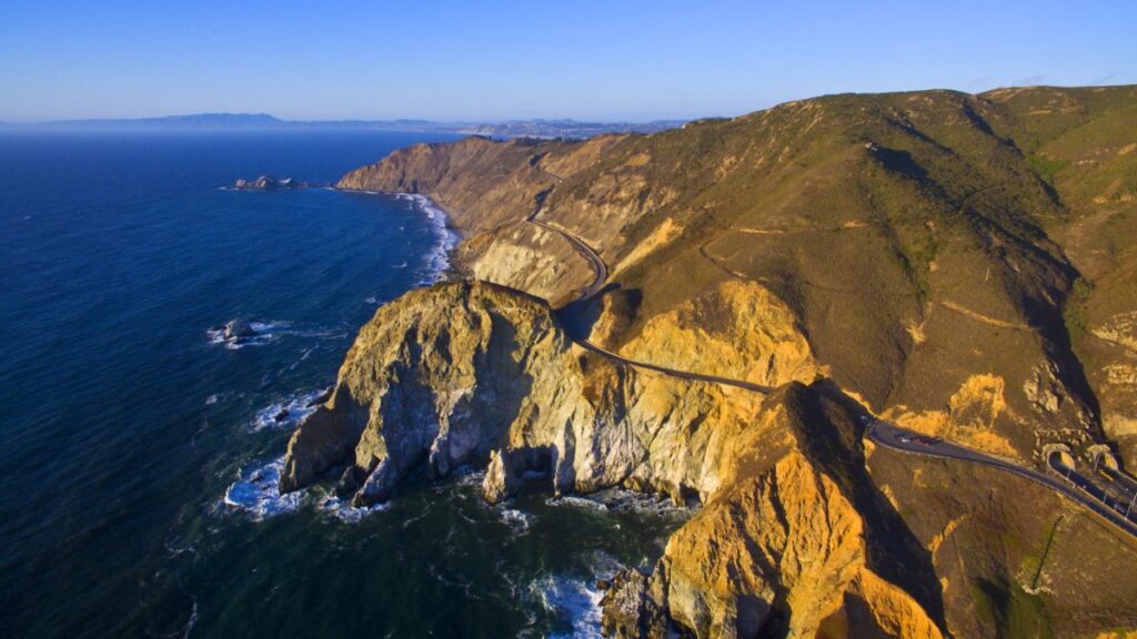
Nestled along the rugged coastline of San Mateo County, California, Devil’s Slide is a dramatic promontory located between the cities of Pacifica and Montara. This steep, rocky cliff earned its ominous name due to its treacherous terrain, which has long posed challenges to travelers and engineers alike.
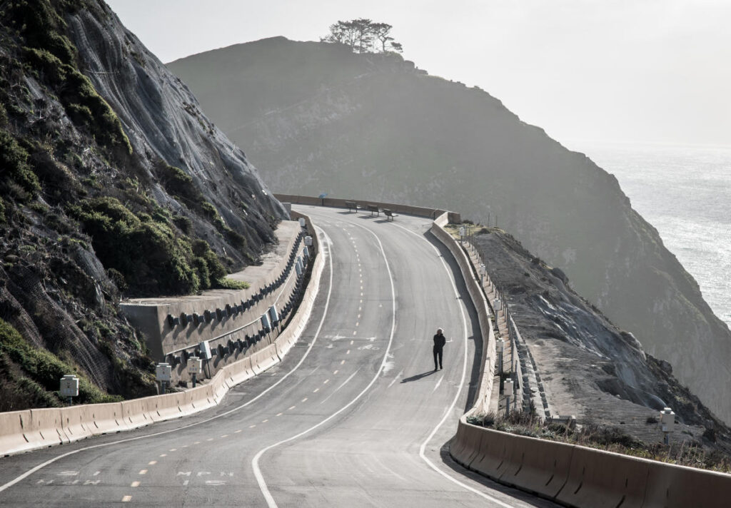
Historically, Devil’s Slide was part of California State Route 1, also known as the Pacific Coast Highway. The road segment was completed in 1937 but was plagued by frequent landslides and erosion, leading to numerous closures— the first occurring just three years after its opening. Drivers often described navigating the winding, cliff-hugging path as a “white-knuckle” experience, with sheer drops to the Pacific Ocean below. To address these ongoing issues, construction on the Tom Lantos Tunnels began in 2005, rerouting Highway 1 underground and bypassing the unstable area. The tunnels opened in 2013, transforming the old roadway into a public trail the following year.
Today, Devil’s Slide Trail is a 1.3-mile paved multi-use path that welcomes hikers, runners, cyclists, and equestrians. As part of the larger California Coastal Trail—a planned 1,200-mile network stretching from Oregon to Mexico—it offers breathtaking panoramic views of the ocean, rocky shores, and migrating marine life. Visitors can pause at scenic overlooks equipped with benches and observation scopes, while interpretive signs provide insights into the area’s geology, history, and wildlife, including seabird nesting sites.
The trail is considered easy, with about 250 feet of elevation gain, making it accessible even for those in wheelchairs. Parking is available at lots on either end, just off Highway 1. Whether you’re seeking a leisurely stroll or a quick bike ride, Devil’s Slide provides a safe way to experience the raw beauty of California’s coast that was once reserved for daring motorists.
Mori Point Trail: Coastal Bliss in Pacifica
Perched on the dramatic bluffs of Pacifica, California, just south of San Francisco, Mori Point is a stunning coastal headland that forms part of the Golden Gate National Recreation Area. This 110-acre site offers a network of trails that wind through wetlands, grasslands, and rugged cliffs, providing breathtaking views of the Pacific Ocean and opportunities for wildlife spotting.
Historically, Mori Point was named after the Mori family, who owned the land in the early 20th century and used it for farming and quarrying. It faced development pressures in the 1980s and 1990s, but community efforts led to its preservation as public parkland in 2000, now managed by the National Park Service. The area is rich in Native American history, with interpretive plaques along the paths highlighting the indigenous Ohlone people’s connection to the land.
The main attraction is the Mori Point Loop Trail, a 2.6-mile moderate hike with about 400 feet of elevation gain, typically taking 1 to 1.5 hours to complete. Starting from the trailhead on Mori Point Road, it features a mix of dirt paths, boardwalks, and stairs, leading to panoramic overlooks where visitors can watch crashing waves, migrating whales (especially from December to April), and vibrant wildflowers in spring. For a more accessible option, the Old Mori Trail is a gentle 1-mile out-and-back path (2.5 miles round-trip including extensions) with minimal elevation, suitable for wheelchairs and families, ending at an ocean viewpoint.
Other trails like the Peak Loop (3.2 miles) offer ridgeline views extending to the Golden Gate Bridge on clear days, while the Coastal Trail connects to nearby beaches and promenades. The site is dog-friendly (on-leash), and parking is free but limited at the main lot off Mori Point Road, with additional spots nearby. Weather can change quickly, so layers are recommended. Whether for a quick stroll or a full afternoon of exploration, Mori Point delivers an accessible slice of California’s raw coastal beauty.


